Fountain Dale
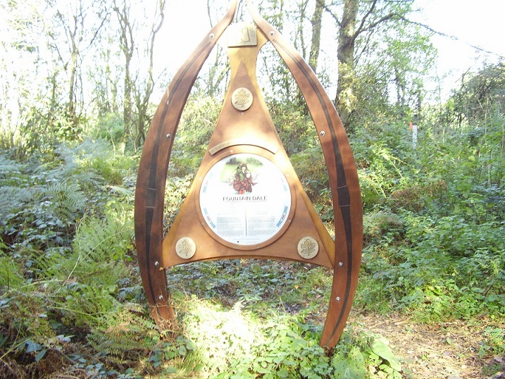
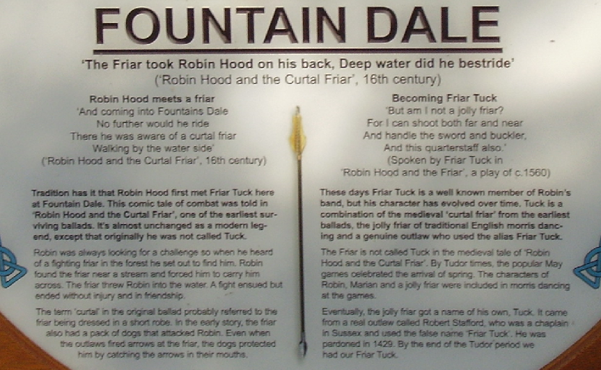
The sign for Fountain Dale by Robin Hood Way, a walking trail planned by members of the Nottingham Wayfarers’ Rambling Club. It was opened in 1985 with the plan of linking all the places in Nottinghamshire that have a connection to the Robin Hood legend. Originally 84 miles long, it was extended to 105. It runs from Nottingham Castle to Edwinstowe and takes in areas such as Sherwood, Farnsfield, Bothamsall, Clumber Park and Creswell. A remnant of Sherwood, Fountain Dale is a wooded area two miles north-west of Blidworth. The ballad Robin Hood and the Curtal Friar probably confuses the site with Fountains Abbey in Yorkshire. Fountain Dale does not appear to be recorded as a place-name until C. and J. Greenwood’s 1826 Map of the County of Nottingham.